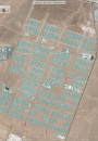
Automated analyses of satellite and sensor imagery: Supporting operations during humanitarian emergencies by detecting geographic structures, using machine learning
Using machine learning for detecting geographic structures and estimating displaced populations in humanitarian emergencies